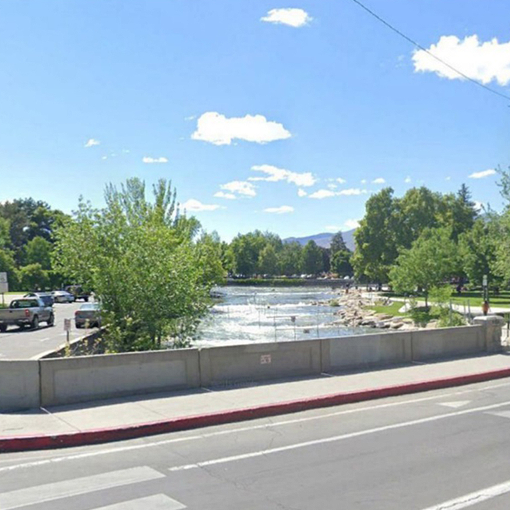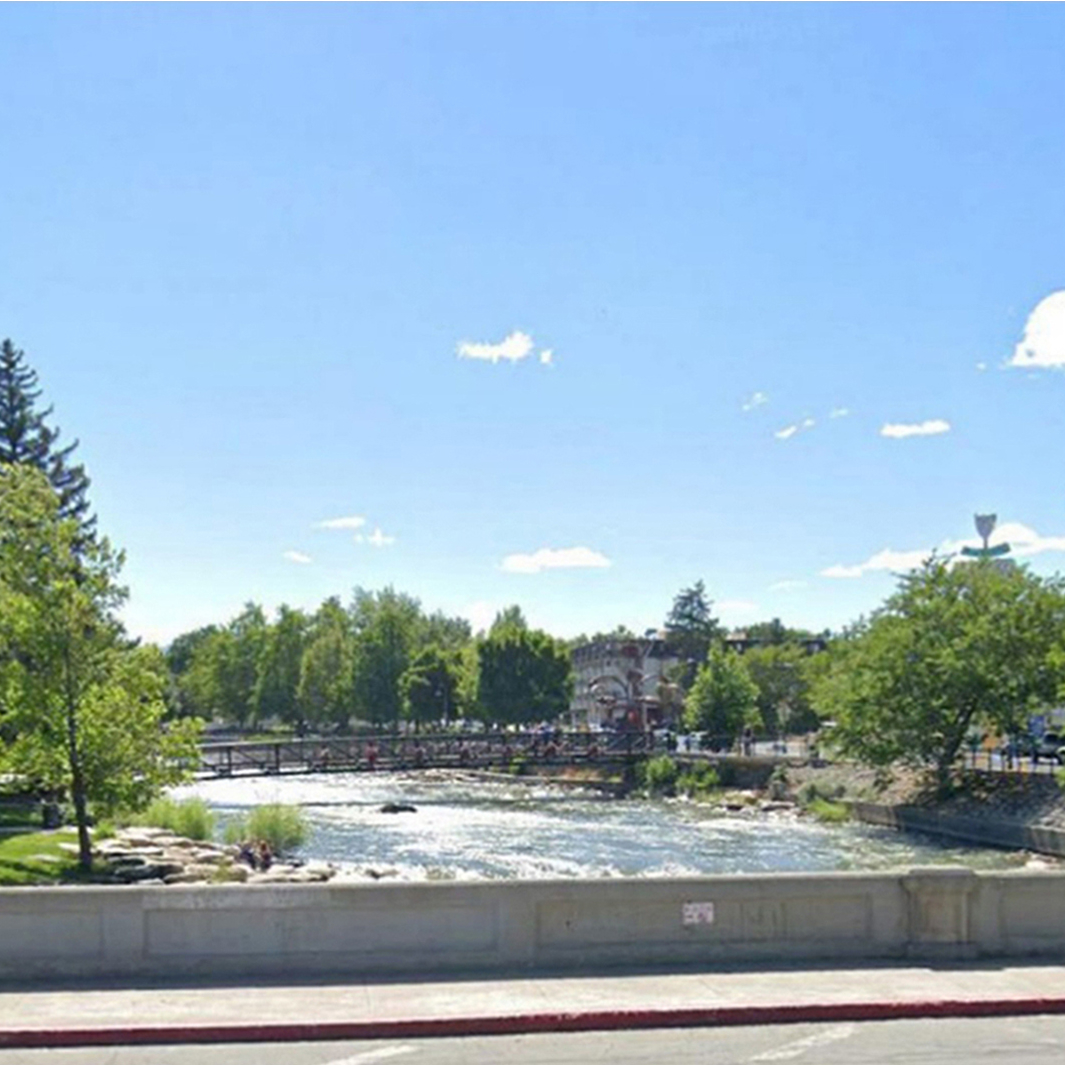
View looking west from
existing North Bridge

ASKED
QUESTIONS
View looking west from
existing South Bridge
Existing North Bridge

ASKED
QUESTIONS
Existing South Bridge
WHAT IS THE PURPOSE OF THIS PROJECT?
The purpose of this project is to:
- Replace existing structurally deficient bridges
- Minimize future flooding
- Replace the pavement on Arlington Avenue between West First Street and Island Drive
- Improve pedestrian safety
- Ensure Americans with disabilities (ADA) compliancy
WHY IS THIS PROJECT NEEDED?
- Improve safety
Both bridges on Arlington Avenue over the Truckee River are more than 100-years-old and are in need of replacement. - Improve Bicycle, and Pedestrian Connectivity
Multi-modal improvements include widening the existing sidewalks to eight feet with an added two-foot buffer between dedicated bike lanes and the vehicle travel lanes. - Improve Flood Mitigation
The new north bridge will have only one pier, compared to the two piers of the existing bridge, providing more unobstructed area in the event of flooding. A new access will be built to help remove debris. The new bridges will provide the same or slightly improved hydraulic capacity compared to the existing bridges. Flooding throughout Wingfield Park and the surrounding area will still occur at the same storm events as flooding occurs now.
WHAT ARE THE PROJECT IMPROVEMENTS?
- Two new structurally efficient and aesthetically pleasing bridges
- Improved river flow
- Continuous eight-foot-wide sidewalks on both sides of Arlington Avenue
- A new river overlook on each side of the north bridge
- Dedicated five-foot bike lane separated from vehicular traffic with a two-foot striped buffer lane
- New roadway surface on Arlington Avenue between West First Street and Island Drive
- Relocation of existing pedestrian beacon and crosswalk from the south side of Arlington Avenue and Island Drive to the north side where pedestrians are more likely to cross.
- Drainage improvements
- Americans with disabilities (ADA) improvements along the project limits to ensure ADA compliancy
CAN THE BRIDGE ELEVATIONS BE RAISED?
No. The existing roadway and nearby building elevations at First Street and Island Avenue prohibit the ability to raise the bridge profiles.
WHAT WILL THE NEW BRIDGES LOOK LIKE?
During the Feasibility Study, an aesthetics theme of Modern Art Deco was selected by the stakeholder working group and endorsed by the public. Preliminary renderings can be viewed here.
WHAT INPUT CAN I PROVIDE ON THE BRIDGE FEATURES?
We want your feedback on aesthetic design features including bridge railing, pedestrian lighting fixtures, and bridge pylons. We created a Build-a-Bridge web tool and survey to receive community input. Both will available on this website soon.
WHAT IS THE LANE CONFIGURATION ON ARLINGTON AVENUE?
There will be one though lane in each direction. The existing dedicated left turn lanes from north and south Arlington Avenue to Island Drive and Barbara Bennet Park will remain. Right turn and through traffic will share a lane.
The existing dedicated left turn lanes from north and south Arlington Avenue to West First Street will remain. Right turn and through traffic will share a lane, allowing room for a dedicated bike lane to continue. In the existing condition, the bike lane ends, and bicycle users must share the right turn lane.
WHAT WILL THE SPEED LIMIT BE ON ARLINGTON AVENUE?
The speed limit will remain 15 MPH for safety.
WHAT ENVIRONMENTAL IMPACTS ARE BEING CONSIDERED?
An Environmental Study is being completed. This study will include analysis on:
- Noise
- Visual Resources
- Biological Resources
- Multimodal (Bike/Ped/Transit)
- Land Use / Social-Economic
- Air Quality
- Water Resources / Wetlands
- Parks / Recreation
- Historic Resources
- Hazardous Materials
- Traffic / Safety
WILL ANY TREES BE IMPACTED?
Preliminary design indicates five trees will be impacted by the construction excavation limits for the new bridges. New trees will be planted once construction is complete. In addition, approximately seven more trees will be planted along Arlington Avenue in accordance with the City of Reno landscaping code to have trees spaced at 30-foot interval for this project location.
All construction information is preliminary and subject to revision.
WHAT ARE THE TRAFFIC IMPACTS DURING CONSTRUCTION?
Arlington Avenue will be closed to through traffic between Island Drive and West First Street.
Anticipated detour routes over the Truckee River include Keystone Avenue and the one-way couplet of Sierra St./Center St.
Eastbound/westbound traffic to/from Arlington Avenue is anticipated to use Second Street and California Avenue.
All construction information is preliminary and subject to revision.
HOW WILL PEDESTRIAN ACCESS TO WINGFIELD PARK AND THE ADJACENT WHITEWATER PARK BE IMPACTED DURING CONSTRUCTION?
Due to safety concerns, the City of Reno has requested full closure of Wingfield Park and the adjacent whitewater park for the duration of construction. Nearby Barbara Bennett Park and West Street Plaza will not be impacted.
All construction information is preliminary and subject to revision.
ARE IMPROVEMENTS TO WINGFIELD PARK AND THE WHITEWATER PARK INCLUDED IN THE SCOPE OF THIS PROJECT?
No, overall improvements to Wingfield Park and the whitewater park are NOT included in this bridge replacement project. Localized impacts within our construction footprint will be restored to their current condition. The City of Reno is in the process of developing a Park Master Plan for possible improvements to Wingfield Park, Barbara Bennett Park, and the whitewater park. The plan is tentatively scheduled to be completed by 2023.
All construction information is preliminary and subject to revision.
WHAT IS THE ANTICIPATED CONSTRUCTION SCHEDULE?
A contractor will be selected in August 2024 with construction of the bridges to begin in July 2025, when access to the river is allowed. Construction is anticipated to be complete by the end of 2026. Construction river access is only allowed from July 1 through October 31 each year. The team anticipates the contractor will build one bridge per season.
All construction information is preliminary and subject to revision.
WHAT IS THE PROJECT COST AND HOW WILL IT BE FUNDED?
The $28.3 million project (design and construction) is being funded through multiple resources:
- $3.3 million COVID Funds (Federal)
- $2.0 million Congressional Directive Funds (Federal)
- $7.0 million Rebuilding American Infrastructure with Sustainability & Equity (RAISE) Grant (Federal)
- $5.9 million Surface Transportation Block Grant (STBG) Funds (Federal)
- $10.1 million Local Fuel Tax (RTC)
All construction information is preliminary and subject to revision.
WHAT ARE THE EXPECTED IMPACTS TO SERVICES AND DRAINS?
The reconstruction of the bridges and their roads will require adjustments to the recently completed elevations, but the functionality of the services will be maintained.
HOW CAN I STAY INVOLVED AND LEARN MORE ABOUT THE PROJECT?
Sign up to receive project updates at: ArlingtonBridges.com.
Please call or email:
Judy Tortelli, P.E. RTC Project Manager
(775) 335-1824
jtortelli@rtcwashoe.com